AG-220 Environmental Change in the High Arctic Landscape of Svalbard (10 ECTS)
ID:
AG-220
CREDITS:
10 ECTS
APPLICATION DEADLINE:
February 15, 2024
START DATE:
July 01, 2024
END DATE:
August 02, 2024

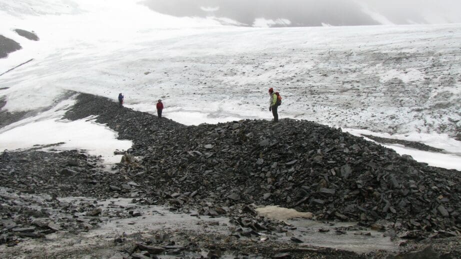
Students on lateral moraine, unnamed cirque glacier, Aagaardtoppen in western Spitsbergen. Photo: Mike Retelle
| Grade: | Letter grade (A through F) |
| Course Cost: | Fieldwork, around NOK 1400 (around 7 days x NOK 200 per overnight stay) |
| Course Capacity Min/Max: | 10/20 students |
| Language of instruction: | English |
| Examination support material: | Bilingual dictionary between English and mother tongue |
Contact person
Course requirements
Enrollment in a physical geography or geology bachelors program. 60 ECTS within general natural science, of which 30 ECTS within the field of geology/geosciences.
The applicant must be enrolled in a programme at Bachelor level, or document that the courses are approved into the applicant’s current study programme.
Academic content
The course investigates how climatic and watershed processes influence the modern glacial, fluvial, lacustrine and periglacial systems in the high Arctic setting of western Svalbard. Excursions to various localities in the vicinity of Longyearbyen will provide an introduction to high Arctic glacial and periglacial processes and environments. Monitoring studies of the rapidly changing Arctic cryo-/hydrosphere at the field site on glaciers and their forefields will extend existing environmental data sets that establish a robust baseline against which future changes will be measured.
During this field course, students will gain experience in aspects of glaciology, geomorphology, fluvial hydrology and sediment transport, and periglacial geomorphology. Students will gain experience in using a network of environmental monitoring instrumentation to interpret seasonal, annual, and long-term changes in high Arctic terrestrial systems.
Learning outcomes
Upon completing the course, the students will:
Knowledge
- have an understanding of the geomorphic, cryospheric, hydrologic, and sedimentological processes and their linkages in glaciated high Arctic watersheds
- have an understanding of modern processes which will further inform their interpretation of late Holocene environmental changes and will allow for more accurate predictions of future environmental changes in the Arctic.
Skills
- measure glacier mass balance and conduct GPS surveys of glacier margins
- set up and maintain monitoring stations including an automatic weather station and stream discharge/gaging station
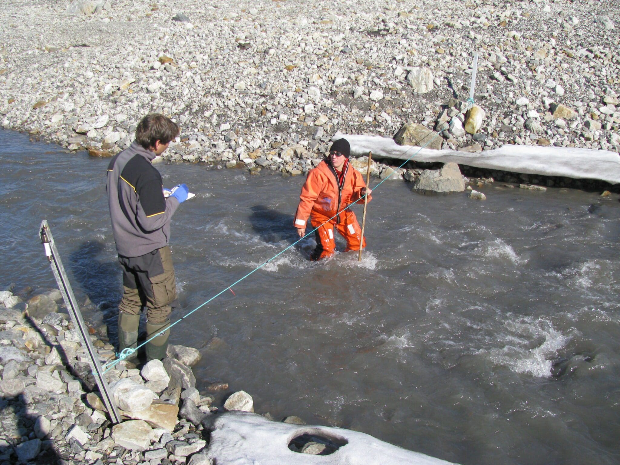
- measure stream discharge and suspended sediment transport
- operate and use data from data loggers and instrumentation including GPS, CTD, automated cameras, automated weather stations, temperature loggers and GIS
- compile and synthesize field data and incorporate and present data in a scientific report.
General competences
- be able to carry out a field research project from initial design, fieldwork, analysis, presentation and production of a final written report
- have first-hand experience in the analysis of the rapid changes taking place in the terrestrial high Arctic environment
- utilize classic and recently published scientific literature to provide broader context for their field study
- utilize data from long-term monitoring at the field sites and contribute to long term environmental data sets.
Learning activities
The course extends over about five weeks, including compulsory safety training. The first ten days of the course will be centered at UNIS. Students will attend introductory lectures and exercises and participate in local field excursions that will provide an introduction to the high Arctic glacial and periglacial system and field techniques. The following two weeks will involve intensive field work undertaken at localities in the vicinity of Longyearbyen. During fieldwork students will be introduced to all aspects of the research activities and trained in field techniques and the use of monitoring and sampling instruments. Data and samples collected will form the basis of independent small research projects co-designed with the course lecturers. Students will work collaboratively as part of various research teams and data collected from logging instrumentation will be shared among students pursuing different research projects.
Student projects will focus on a wide range of topics: controls on glacier mass balance, meltwater stream discharge and sediment transport. Alternatively, students may design a project that is related to the main theme of the research in the watersheds. At UNIS students will have the opportunity to work in the evening on data and samples and will present progress reports on their research topics.
At the completion of the fieldwork, students will synthesize data and analyze samples at UNIS under the supervision of the course faculty. During the last week, students will deliver a final presentation and a written report on their research.
Attending students must be aware that field work involves hikes of at least 10 km per day over rough terrain.
Summary
- Total lecture hours: 12 hours
- Fieldwork: Up to 20 days at field sites in glacial watersheds in the region around Longyearbyen
- Laboratory work and data analysis: 10 days
- Final presentations: 1 day
Compulsory educational activities
All compulsory educational activities must be approved in order to sit the exam.
- Student presentations
- Fieldwork
- Field excursions
- Laboratory work and/or data analysis
Assessment
All assessments must be passed in order to pass the course.
Each assessment is graded and subsequently combined into a single grade. Partial grades for each assessment will be available.
| Method | Percentage of final grade |
| Oral presentation of research proposal | 20 % |
| Oral presentation of fieldwork, progress report | 30 % |
| Field skills and field notebook assessment | 10 % |
| Written final report | 40 % |
Student life


